WHY THIS LOCATION MATTERS
A landscape that defines West Cornwall
Roseworthy sits high on the gateway to West Cornwall, within an open and deeply layered landscape shaped by farming, historic mining and long views stretching between coast and countryside.
Carn Brea, one of Cornwall’s most recognisable historic and ancient landmarks, rises across this wider setting, while Roseworthy’s legacy of centuries of mining remains written into the land itself.
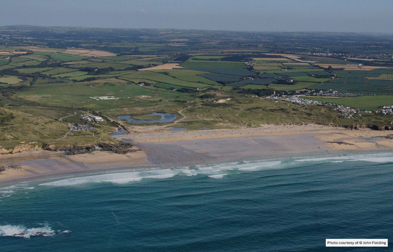
This is not an enclosed or visually isolated site.
The proposed development occupies an exposed ridge within a much wider area whose character and significance extend far beyond the red line of a planning application.
The site is clearly visible from Carn Brea, around five miles away — a striking demonstration of just how exposed this site location is within the wider landscape.
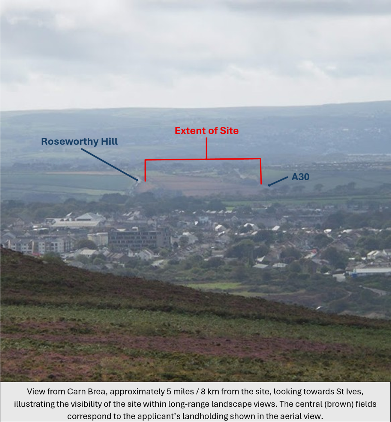
A MAJOR INDUSTRIAL WASTE COMPLEX HERE WOULD NOT SIMPLY OCCUPY A FIELD.
It would insert acres of concrete, large-scale earthworks, a vast industrial building and continuous waste-processing activity.
Disfiguring the wider landscape at the gateway to West Cornwall.
A building 72 metres long, 32 metres wide and 10 metres high can never be simply hidden behind trees and shrubs or prettified with a few wildflowers. Whatever planting may establish over time, it cannot conceal the scale, elevated position or permanent industrial presence of what has been approved.
That wholly incongruous industrial intrusion would always be experienced in close and long-distance views across this remarkable landscape.
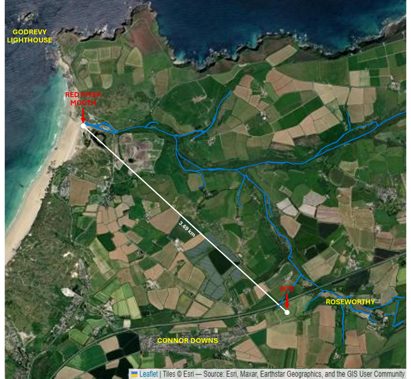
There are watercourses on, beside and beneath the site. Watercourses also flow from and around Roseworthy, into the wider Red River catchment, creating physical pathways that extend far beyond the boundary of the proposed development.
These waters pass through a countryside shaped by centuries of mining before the Red River reaches the sea at Godrevy.
In a former mining landscape with documented arsenic and heavy-metal contamination, concerns about what may enter connected waters upstream cannot be trivialised.
These concerns cannot simply be confined to a red line on a planning map.
WHAT HAPPENS UPSTREAM HAS THE POTENTIAL TO TRAVEL DOWNSTREAM.
CONNECTIVITY MATTERS
From the Roseworthy Valley, through local watercourses and the wider Red River catchment, to the dunes, headlands and waters of St Ives Bay, this is an ecologically connected and living environment.
This is not a collection of isolated habitats.
At its coastal end lie Godrevy and the Towans – part of a wider network of protected sites and rare habitats that includes the Godrevy Head to St Agnes SSSI, where grey seals are a notified feature, alongside wildlife-rich headlands, coastal heathland and rare and highly specialised dune habitats. The site also sits in the buffer zone of three other SSSIs – Gwithian to Mexico Towans SSSI, Hayle Estuary and Carrack Garden SSSI, and Loggans Moor SSSI.
Within this connected environment, productive farmland and recovering waterways sit alongside an extraordinary diversity of flora and fauna, including rare, threatened and legally protected species.
BUT THIS ECOLOGICAL SYSTEM DOES NOT BEGIN AT THE RED LINE OF A PLANNING APPLICATION – AND IT DOES NOT END THERE.
Water moves through it.
Species move through it.
Predators depend upon prey.
Habitats function in relation to neighbouring habitats.
WHAT HAPPENS IN ONE PART HAS CONSEQUENCES FAR BEYOND IT.
This development isn’t creating biodiversity where none exists. It is being imposed upon an existing, functioning and interconnected ecological system.
The examples shown here are only a glimpse of that wider ecological richness – from otters and internationally rare Petalwort to highly specialised butterflies, Cornwall’s iconic choughs and the grey seals that haul out at Godrevy.
THIS IS A LIVING, INTERCONNECTED AND HIGHLY FRAGILE ECOLOGICAL NETWORK…
WHERE WATER, WILDLIFE AND ENVIRONMENTAL RISK DO NOT STOP AT FIELD BOUNDARIES OR AT THE EDGE OF A PLANNING APPLICATION SITE.
MEET THE LOCALS
OTTER
The Red River – one of the most modified streams in the UK after centuries of mining, heavy-metal contamination and alteration of its course – has seen otters return from almost none to good numbers of records today.
The otter (or dowrgi in Cornish) is afforded the highest level of protection as a European Protected Species.
It is a UK priority Biodiversity Action Plan species and is listed in the Cornwall and Isles of Scilly Red Data Book. The otter and its resting places are fully protected by law and it is an offence to deliberately or recklessly disturb an otter or its holt.
Forty years ago pollution was responsible for dramatic declines in the otter population, but the otter’s hard-won return is a powerful symbol of ecological recovery in this connected waterway.
And of what must not be lost again.
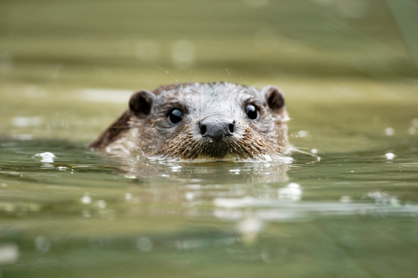
River Otter (Lutra lutra)
PETALWORT
Petalwort is internationally rare, legally protected, listed under European nature-conservation law and recorded in Cornwall’s Red Data Book.
Surviving in the specialised damp dune habitats of the Hayle–Gwithian Towans, Petalwort is dependent on precise moisture conditions and vulnerable to habitat change.
This tiny and easily overlooked species can disappear before most people ever realise it was there.
Yet Petalwort remains one of the rarest and most vulnerable inhabitants of the Towans landscape at the coastal end of this connected environment.
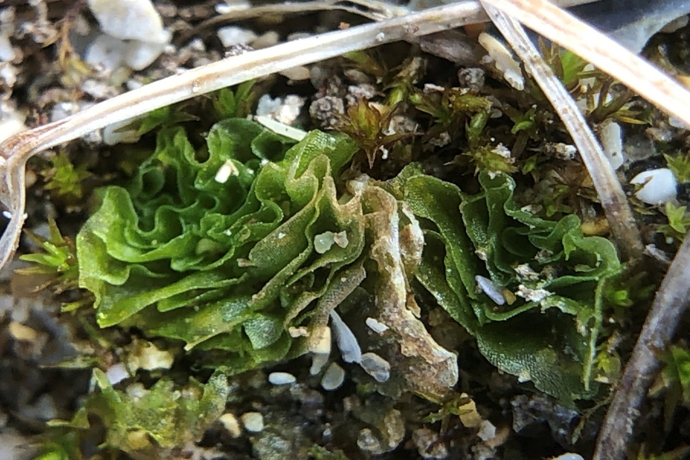
Petalwort (Petalophyllum ralfsii) © Young Jun Lee, CC BY 4.0
SILVER-STUDDED BLUE
The Silver-studded Blue is extremely rare, highly specialised and in major decline across much of its range.
But this delightful butterfly survives in close-knit, and sometimes huge, colonies providing a truly amazing spectacle across the Towans landscape around Gwithian and Godrevy.
Its dependence on precise habitat conditions and intricate relationships with ants makes it a powerful symbol of an ecosystem whose value lies in connections that are easily disrupted.
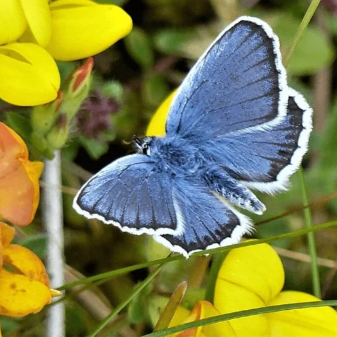
Silver Studded Blue Butterfly (Plebjus argus) - courtesy of Cornwall Butterfly Conservation
“It seems to me that the natural world is the greatest source of excitement; the greatest source of visual beauty; the greatest source of intellectual interest. It is the greatest source of so much in life that makes life worth living.”
Sir David Attenborough – Butterfly Conservation President
HORNET ROBBERFLY
At 2.5–3 cm long, the Hornet Robberfly is an extraordinary creature and one of Britain’s largest and rarest flies.
With enormous eyes, long spiny legs and a distinctive hairy “moustache”, it is a formidable aerial predator — but harmless to people.
A UK Conservation Priority Species, it only survives in around 40 isolated breeding sites. It depends on insect-rich grassland and heath, but is also found in open woodland clearings and marshy grassland — all part of the interconnected mosaic of habitats found right here, from the Roseworthy site through the Red River corridor towards Gwithian and Godrevy.
Britain has already lost a startling 97% of its wildflower meadows. Since the 1970s, ecologically important groups have declined significantly: pollinators have declined in distribution by 18% and predatory insects by 34%.
Here in Cornwall, Buglife’s Kernow Wyls – People for Pollinators project works to restore and reconnect fragmented habitats for threatened invertebrates. Buglife is currently seeking Hornet Robberfly records like this one.
And now, with this sighting we know that this extraordinary species is definitely another Local.
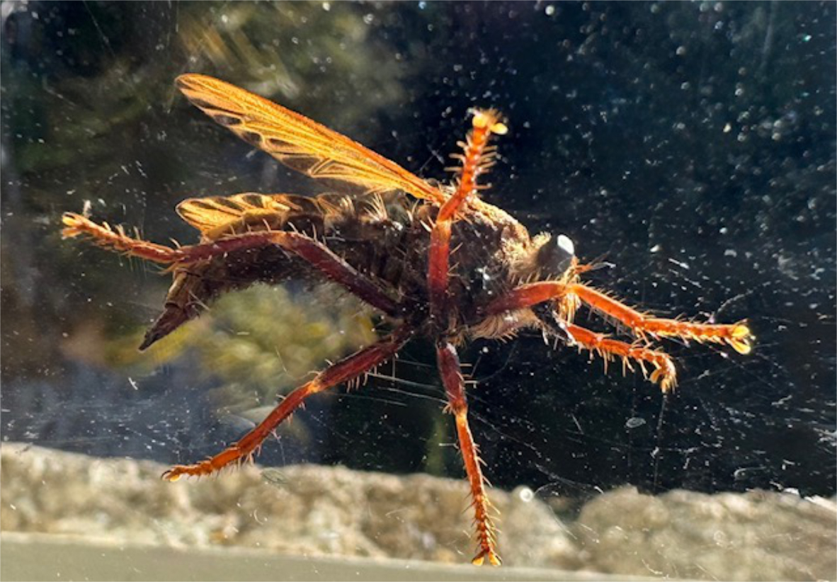
Hornet Robberfly (Asilus crabroniformis)
Photographed in Roseworthy, 22 August 2026. Identification confirmed by Buglife; the sighting will be added to iRecord.
CORNISH CHOUGH
Once lost from Cornwall, the red-billed chough has returned in one of the county’s most celebrated conservation recoveries and this rare and feted bird now can be seen in and around Godrevy.
Protected by law and so deeply entwined with Cornwall’s natural and cultural identity that it appears on the Cornish coat of arms, and, according to legend, King Arthur turned into a chough on his death.
Few species better symbolise what determined conservation can restore.
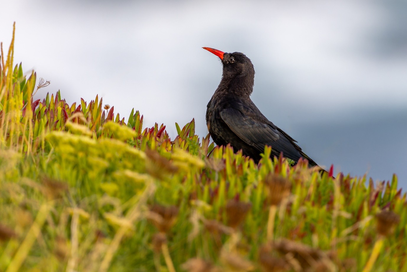
Cornish Chough ( Pyrrhocorax pyrrhocorax)
GREY SEAL
Although one of the world’s rarest seal species, around a half of the global population are found in UK waters.
The Atlantic grey seal is protected under UK law and recognised under European conservation law.
Atlantic grey seals haul out in big groups to rest, digest their food, socialise and have their pups. They congregate at Mutton Cove, Godrevy, within one of only two SSSIs in Cornwall where the species is specifically recognised as a notified feature.
Cornwall’s own Godrevy therefore carries a heightened responsibility for the Atlantic grey seal continued survival and wellbeing.
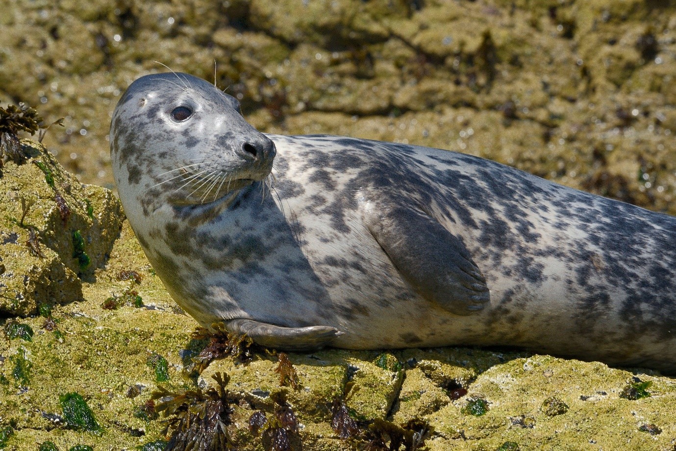
Atlantic Grey Seal (Halichoerus grypus atlantica)
FOOD-GROWING LAND
Productive fields immediately beside and surrounding the proposed site grow crops that enter field-to-fork supply chains across the UK.
Arsenic and other toxic heavy metals are already documented in the surrounding mining landscape and on the site itself.
The risk of contaminants moving beyond the site during construction and operation through water, soil and airborne dust raises serious concerns for neighbouring farmland, farm workers and food production.
Food security begins here.
What grows here reaches dinner tables far beyond Roseworthy.
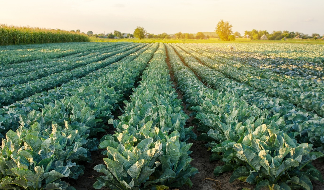
Food Producing Fields
WHAT HAPPENS HERE DOESN’T STAY HERE
The approved site occupies an elevated position above the Roseworthy Valley, beside highly productive farmland and close to homes, with connected water pathways extending into the wider Red River catchment below.
Major earthworks, large-scale waste processing, wood shredding, heavy traffic and permanent industrial activity in this location create multiple pathways by which impacts can extend beyond the site itself.
Through water.
Through soil.
Through airborne dust.
Through HGV traffic.
Through noise.
Through odour.
Through emissions.
Through bioaerosols.
THIS IS NOT A SMALL AND BENIGN COMPOSTING OPERATION. IT IS PERMANENT INDUSTRIAL WASTE INFRASTRUCTURE.
The concern is not simply what happens inside the site boundary.
It is what can move beyond it.
Water flows downhill.
Dust, odour and bioaerosols travel on the wind.
Roads connect contamination with communities.
WHAT IS DISTURBED, RELEASED OR LOST HERE CAN CARRY CONSEQUENCES FAR BEYOND THE DEVELOPMENT ITSELF.
SO WHAT HAS BEEN APPROVED?
The planning application runs to hundreds of pages of reports, plans and technical documents. The decision notice contains dozens of conditions.
None of that changes what was actually permitted.
FORGET THE PAPERWORK. LOOK AT THE SUBSTANCE.
THIS IS WHAT CORNWALL COUNCIL REALLY APPROVED.
LOOK CLOSER AT WHAT HAS BEEN APPROVED – EXPLORE HERE
- 38,000 TONNES OF WASTE A YEAR? HARDLY. THAT’S JUST THE START. (Read More)
- MORE THAN FOUR ACRES OF HEAVY CONCRETE. HIGH ON THE RIDGE… (Read More)
- INDUSTRIAL COMPOSTING. THESE AREN’T JUST BIG GARDEN COMPOST HEAPS. (Read More)
- A BUILDING THIS HUGE ISN’T JUST THERE FOR SHOW. (Read More)
- END-OF-LIFE WOOD ISN’T CLEAN TIMBER. ESPECIALLY WHEN SHREDDED IN… (Read More)
- WHAT HAPPENS TO THE CONTAMINATED FARM PLASTICS? STORED. UNCOVERED. OUTSIDE. (Read More)
- ONCE THIS HILLSIDE IS IRREVERSIBLY RE-ENGINEERED, YOU CAN’T PUT IT BACK. (Read More)
- 3.3 MILLION LITRES OF DIRTY WATER HELD HIGH ABOVE THE VALLEY. (Read More)
- WHAT HAPPENS WHEN MILLIONS OF LITRES OF DIRTY WATER MEETS EXTREME RAINFALL? (Read More)
- AND ALL THOSE THOUSANDS UPON THOUSANDS OF LORRIES HAVE TO GET HERE SOMEHOW… (Read More)
- ARSENIC & HEAVY METALS ARE ALREADY RIGHT HERE. EXTRAORDINARY HIGH… (Read More)
- DOWNWIND. DOWNSTREAM. WHAT HAPPENS IF THE CONTAMNINATION GENIE IS… (Read More)
- A LIVE GAS MAIN ACROSS THE SITE. A PRESSURE REDUCTION STATION BESIDE THE… (Read More)
- THE APPLICANT’S OWN 2019 ODOUR ASSESSMENT TELLS A VERY SMELLY STORY… (Read More)