THIS IS NOT A THEORETICAL VALLEY DRAWN ON A DRAINAGE MODEL
Directly below the approved site lies a documented, real-world drainage system
The water already runs downhill, collects in fields, emerges through springs, floods lower ground and has required repeated intervention simply to keep it under control.
However, the technical assessments repeatedly concentrated on the application site and its immediate surroundings within 50 metres.
Yet the real question was never simply whether the hilltop would flood.
It was what happens when water leaves the site and enters the connected valley below — and the consequences if that landscape is not adequately protected.
One adjoining landowner has lived here for 40 years.
During consultation he described a continual battle with water draining from higher ground, a spring on the boundary with the applicant’s land whose flow increases during wet winter months, repeated flooding of the lower fields and protective ditches he first dug — and later had to enlarge — to help protect his much lower-lying property from increasing flows.
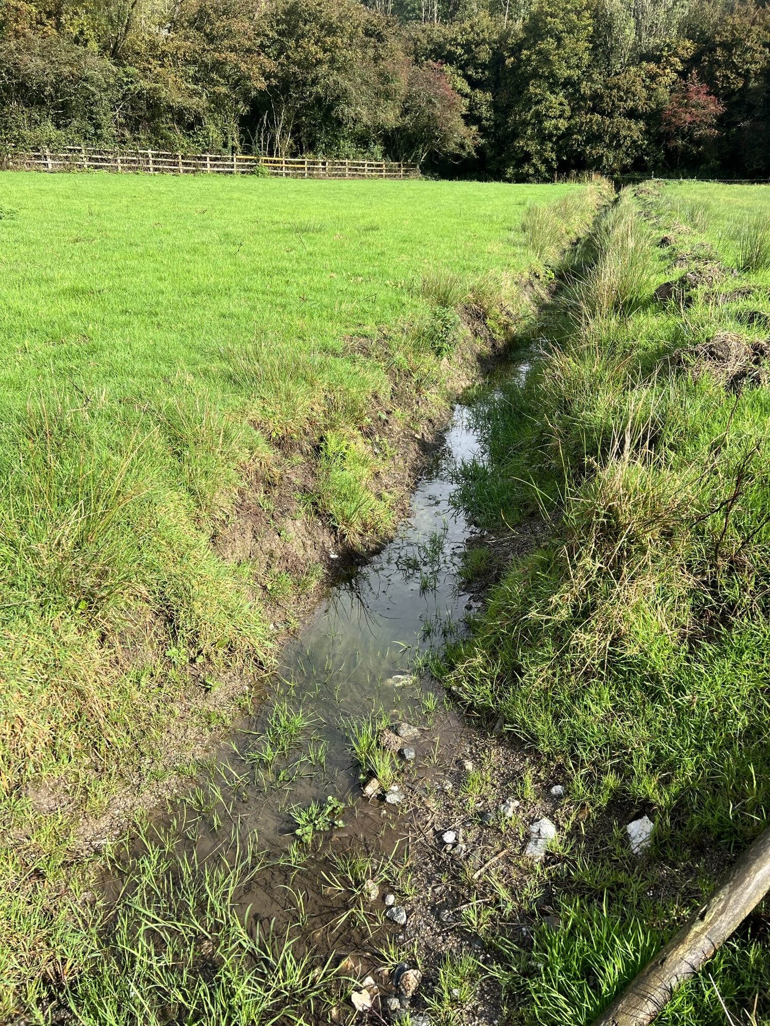
One of many water-filled drainage ditches at New Mill, Roseworthy
His evidence was not speculative. It was strikingly specific.
Because it documented not a theoretical future flood risk, but impacts already experienced in the land immediately below and adjoining the approved site.
Water already drains downhill from the applicant’s land towards the spring and lower fields. He warned that additional water dispersed onto the higher fields around the waste facility would percolate through the ground and return downslope towards that same spring and his land below.
Looking through his deeds, he discovered that one of the fields proposed for dispersing process run-off is called “Well Field” — and asked whether that did not itself point to an already substantial presence of water in the ground.
His concern was direct.
Could additional water from the processing plant exceed the land’s ability to absorb more, further saturating fields that already flood and rendering them too wet for livestock or cultivation?
And the documentary record goes further.
In 2002, Cornwall County Council itself took a formal easement across his land for a highway surface-water drain at New Mill Farm, Roseworthy. The Council therefore had its own direct history of drainage intervention in the very valley now lying below this approved industrial waste site.
Yet even those measures have not ended the problem. The protective ditches remain essential and have had to be much enlarged as flows increased.
THIS IS NOT A HYPOTHETICAL DRAINAGE PATHWAY INFERRED FROM A MODEL.
It is real water moving through a real connected landscape.
From higher ground to spring, field, ditch, property and valley below — a pattern observed over decades and serious enough to require both private intervention and formal Council drainage works.
The Council’s conditions also require groundwater monitoring and testing on the site before construction even begins. Planning permission was therefore granted before those site-specific groundwater conditions had been established, with the groundwater monitoring relied upon in support of the application previously undertaken on a different site.
NOW PLACE THE APPROVED DEVELOPMENT ABOVE THAT LANDSCAPE.
Millions of litres of dirty water would be collected and managed on a radically cut-and-filled industrial platform high above the valley.
The semi-lined attenuation pond is the final point of containment — yet the Flood Risk Assessment and Drainage Strategy identifies an overland exceedance route towards the agricultural fields to the east when the system’s capacity is exceeded.
At the public consultation in summer 2024, the drainage engineer agreed there was a risk of contaminated wood-waste water entering the attenuation pond and escaping off site during heavy rainfall. He also stressed that the attenuation pond was not a wildlife pond and raised concerns about high levels of nitrogen accumulating in the pond, increasing risks of stagnation and odour. The applicant’s own assessments separately identify nitrates in green-waste runoff.
That concern was not abstract.
The land below already carries water downhill. It already floods. It already requires ditches and engineered drainage.
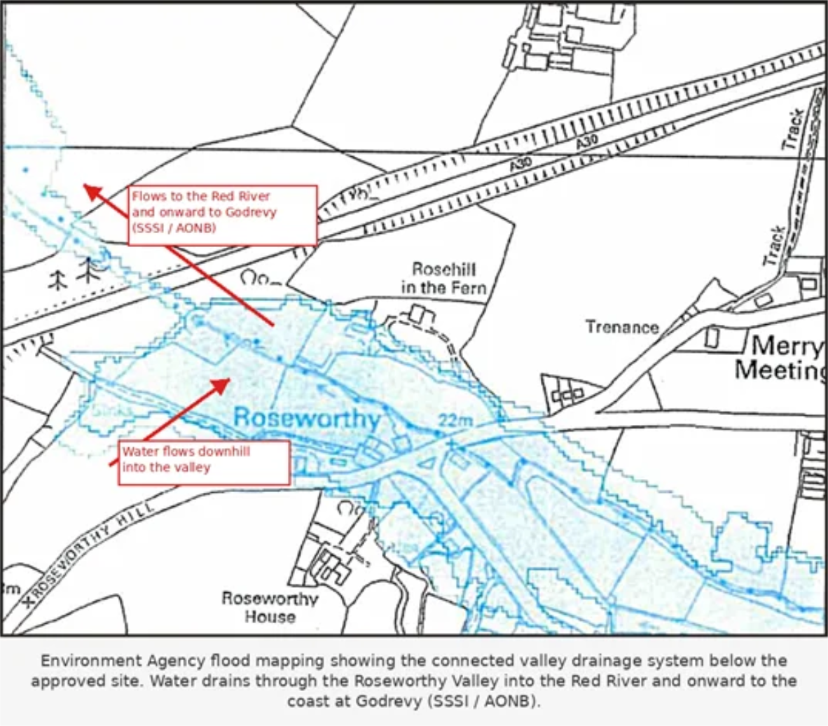
And the route does not end at a field boundary.
Water drains through the Roseworthy Valley into the Red River and onward towards the coast at Godrevy.
This is why overflow cannot be dismissed merely as a line on an exceedance plan.
Once dirty water leaves the final point of containment, it enters a landscape already organised by gravity and water. Neither recognises planning boundaries nor stops at drawn red lines on a plan.
The engineer acknowledged the risk.
The design acknowledges exceedance.
The Council knew the valley’s documented drainage history.
THE WRITING IS ON THE WALL…
ANY ESCAPING WATER IS NOT CLEAN WATER.
THE VALLEY AND ITS WATERWAYS LEADING TO THE SEA STILL LIE BELOW.